
Italy is a country of extraordinary geographical diversity located in southern Europe. Its territory largely corresponds to the Italian geographical region, featuring the iconic boot-shaped Italian Peninsula, the southern flanks of the Alps, the vast Po Valley, and major islands including Sicily and Sardinia. Positioned as a natural bridge between continental Europe and Africa, Italy lies entirely in the Northern Hemisphere, with two Pelagian Islands (Lampedusa and Lampione) technically resting on the African continental shelf.
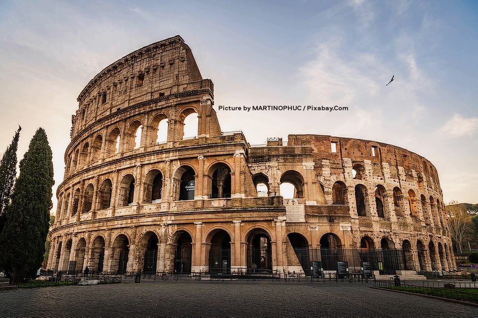
The picture above captures the majestic Colosseum in Rome, Italy, bathed in the warm light of a clear day with a bright blue sky and scattered white clouds overhead, where a lone bird soars near the upper right. The ancient amphitheater’s massive stone facade dominates the scene, featuring multiple tiers of grand arches and columns that have weathered over centuries, with the partially collapsed upper level exposing its inner brickwork and structural details while the lower levels remain more intact and imposing. In the foreground, a wide cobblestone plaza stretches out, dotted with modern metal barriers and railings that guide visitors around the historic site, and tall slender trees stand sentinel on the left side, adding a touch of natural greenery to the timeless architectural wonder. Picture by MARTINOPHUC / Pixabay.Com.
Size, location, and boundaries
Italy covers a total area of 301,230 km² (116,310 sq mi), of which 294,020 km² (113,520 sq mi) is land and 7,210 km² (2,784 sq mi) is water. It extends between latitudes 35° and 47° N and longitudes 6° and 19° E. The broader Italian geographical region spans approximately 324,000 km² (125,000 sq mi) and includes territories now belonging to Croatia, France, Slovenia, and Switzerland, as well as the microstates of Monaco, Malta, San Marino, and Vatican City.
The country shares land borders totaling 1,836.4 km (1,141.1 mi) with Switzerland (698 km or 434 mi), France (476 km or 296 mi), Austria (404 km or 251 mi), and Slovenia (218 km or 135 mi). San Marino (37 km or 23 mi) and Vatican City (3.4 km or 2.1 mi) are fully enclosed enclaves. Including all islands, Italy possesses a coastline of about 7,900 km (4,900 mi) along the Adriatic, Ionian, Tyrrhenian, Ligurian, and Sardinian seas, plus the Strait of Sicily.
General features and position
Italy is anchored to Europe by the Alps in the north and projects southward into the Mediterranean Sea, dividing the western basin (Tyrrhenian Sea) from the eastern basin (Ionian Sea). The peninsula lies at the center of the Mediterranean, between the Balkans to the east, the Iberian Peninsula to the west, North Africa to the south, and continental Europe to the north. Sicily is separated from Tunisia by only 140 km (87 mi) across the Strait of Sicily, while the Salento Peninsula in Apulia lies just 70 km (43 mi) from Albania at the narrowest point of the Strait of Otranto.
No inhabited center in Italy is more than 294 km (183 mi) from the sea; the farthest municipality is Madesimo in the province of Sondrio. The landscape is dominated by hills (41.6% of the territory), followed by mountains (35.2%) and plains (23.2%).
Extreme points
Italy’s extreme points reflect its elongated north–south shape and its strategic position as a bridge between Europe and Africa. Precise surveys have refined some of these locations over time.
- Northernmost: Testa Gemella Occidentale in Prettau (Predoi), South Tyrol (47°5′N 12°11′E). Until 1997, Vetta d’Italia was regarded as the northernmost point; a later survey established that the actual extremity lies 400 m (1,300 ft) further north. Predoi is the northernmost municipality.
- Southernmost (entire territory): Punta Pesce Spada on Lampedusa (35°29′N 12°36′E), which technically lies on the African continental shelf; (mainland): Capo Spartivento in Palizzi, Calabria (37°55′N 15°59′E). The southernmost municipality is Lampedusa e Linosa.
- Westernmost: Rocca Bernauda in Bardonecchia, Piedmont (45°6′N 6°37′E). Bardonecchia is the westernmost municipality.
- Easternmost: Capo d’Otranto (also known as Punta Palascìa and marked by a historic lighthouse) near Otranto in Apulia (40°6′N 18°31′E). Otranto is the easternmost municipality.
The maximum north–south distance between the northernmost and southernmost points is 1,291 km (802 mi), while the widest east–west span is approximately 600 km (370 mi).
Elevation
- Highest point: Mont Blanc (Monte Bianco), Aosta Valley – 4,810.90 m (15,783.8 ft)
- Lowest point: Jolanda di Savoia, Ferrara province – −3.44 m (−11.3 ft)
- Highest settlement: Trepalle, Livigno – 2,209 m (7,247 ft)
Maritime claims
- Territorial sea: 12 nautical miles
- Continental shelf: 200 m depth or to the depth of exploitation
- Exclusive Economic Zone: 541,915 km² (209,235 sq mi)
Territorial divisions
The geography of Italy is traditionally described by distinguishing the political boundaries of the Italian Republic from the broader Italian geographical region (which is larger and includes sovereign territories of neighboring countries and the four microstates). Within this framework, Italy is conventionally divided into three main geographical sections, each with distinct physical and historical characteristics:
Continental Italy (also referred to as Northern Italy in its broadest geographical sense) encompasses the southern side of the Alps, the entire Po Valley, Liguria, and the northern portion of the Apennines up to the conventional line connecting La Spezia on the Tyrrhenian coast to Rimini on the Adriatic. This section forms the “continental” part of the country and includes some areas that are politically part of the Republic but lie outside the traditional geographical region (such as Val di Lei, Livigno, and certain border valleys), while historically Italian territories like the County of Nice and parts of Italian Switzerland are excluded from the Republic but included in the wider geographical definition.
Peninsular Italy covers the remainder of the Italian Peninsula south of the La Spezia–Rimini line, stretching all the way to its southernmost tip at Punta Melito in Calabria and Santa Maria di Leuca in Apulia. This section corresponds roughly to Central and Southern Italy and contains the main body of the Apennine chain. Although San Marino and Vatican City lie within this zone, they remain independent sovereign enclaves; both are nevertheless considered part of the traditional Italian geographical region.
Insular Italy consists of the two major islands of Sicily and Sardinia together with hundreds of smaller islands and archipelagos scattered across the surrounding seas. Corsica, while geographically part of the Italian region, is politically part of France. The five largest islands belonging to the Italian state, in order of size, are Sicily (25,707 km² or 9,926 sq mi), Sardinia (24,090 km² or 9,300 sq mi), Elba (223 km² or 86 sq mi), Sant’Antioco (108.9 km² or 42.0 sq mi), and Pantelleria (83 km² or 32 sq mi). Prominent archipelagos include the Tuscan Archipelago (with Elba as its centerpiece), the Aeolian Islands (including the active volcano Stromboli), the Aegadian Islands west of Sicily, the Pelagian Islands (Lampedusa, Linosa, and Lampione), and several smaller groups such as the Phlegraean Islands, Pontine Islands, and the Maddalena Archipelago off Sardinia.
Orography: mountains, hills, and plains
Mountains cover nearly 40% of Italy and give the country its dramatic vertical profile. The Alps form a 1,000 km (620 mi) arc along the northern border, surrounding the Po Valley to the north, east, and west and creating a natural barrier with continental Europe. The Apennines run like a 1,350 km (840 mi) backbone down the entire peninsula from Liguria to Calabria (continuing into northern Sicily), linking to the Alps at the Colle di Cadibona pass. Nineteen Italian regions are crossed by the Alps, the Apennines, or their offshoots, while Sardinia features its own distinct Sardinian-Corsican mountain system. Italy’s highest peaks lie in the Western Alps, with numerous summits exceeding 4,000 m (13,000 ft), including Mont Blanc (4,810 m or 15,783.8 ft, the highest in the European Union), Monte Rosa (4,634 m or 15,203 ft), and the Matterhorn/Cervino (4,478 m or 14,692 ft). The Apennines’ highest point is Gran Sasso d’Italia (2,912 m or 9,554 ft). Other celebrated ranges include Gran Paradiso in the west and the Bernina, Stelvio, and Dolomites in the east.
Hills occupy the largest share of territory (41.6%) and dominate much of central and southern Italy, especially along the flanks of the Apennine ridge and in the pre-Alpine belt. These gentle reliefs rarely exceed 800 m (2,600 ft), with slight slopes that alternate with valleys and hollows. Key systems include the subalpine hills (widest in the western Po Valley, where they form the Langhe and Monferrato), the Pre-Apennines, the Tyrrhenian Anti-Apennines (from Tuscany’s Colline Metallifere to Vesuvius and the Beneventane Hills in Campania), and the Adriatic Anti-Apennines (notably the Murge and Gargano in Puglia). Their origins vary widely: sedimentary hills (such as the Langhe, Monferrato, Chianti, and Murge) were uplifted from ancient seabeds; the Beneventane Hills are tertiary formations of gravel, pebbles, limestone, and sandstone from former lake beds; morainic hills (Brianza, Canavese, and those at the foot of the Alps) consist of glacial deposits; and volcanic hills (the Euganean Hills and many in Tuscany, Lazio, and Campania) are the eroded remnants of extinct volcanoes.
Plains account for 23.2% of the national territory and are concentrated in the north. The Po Valley is by far the largest, covering 46,000 km² (18,000 sq mi)—more than 70% of Italy’s total flat land—and stretching 652 km (405 mi) from the Cottian Alps to the Adriatic. It is divided into the higher plain bordering the Alpine and Apennine hills and the lower central plain extending to the Po delta. In the peninsula and islands, plains are smaller and typically coastal or at river mouths, such as the Tavoliere delle Puglie, the Campidano in Sardinia, and the Maremma in Tuscany. Most Italian plains are of alluvial origin, built from river-deposited sediments (including the Po Valley, Valdarno, Pontine Marshes, and many coastal flats). Others, like the Tavoliere delle Puglie (Italy’s second-largest plain), are rising plains formed by the uplift of former seabeds, while volcanic plains such as the Plain of Campania were created when volcanic ash filled surrounding valleys.
Hydrography: rivers and lakes
Italy’s rivers are relatively short due to the Apennine divide but numerous thanks to rainfall and Alpine snowmelt. The longest is the Po (652 km or 405 mi), which drains the entire Po Valley and empties into the Adriatic. Other major rivers include the Adige (410 km or 250 mi), Tiber (405 km or 252 mi), Adda (313 km or 194 mi), Oglio (280 km or 170 mi), Tanaro (276 km or 171 mi), and Ticino (248 km or 154 mi). Most drain into the Adriatic or Tyrrhenian seas.
Italy has over 1,000 lakes. The largest subalpine lakes—Garda (370 km² or 143 sq mi), Maggiore, Como (deepest at 410 m or 1,350 ft), and others—were carved by ancient glaciers. Volcanic lakes (Bolsena, Bracciano) and coastal lagoons (Venice, Grado, Orbetello) add further variety. Historic wetlands have largely been reclaimed, but protected areas like the Valli di Comacchio remain.
Seas and coasts
Italy’s 7,900 km (4,900 mi) coastline offers remarkable variety. The Adriatic coasts are mostly low and sandy in the north, with prominent headlands at Gargano and Conero. The Ionian features broad sandy shores and the wide Gulf of Taranto. The Tyrrhenian is highly indented, with rocky headlands, deep gulfs (Naples, Salerno), and alternating beaches. The Ligurian Sea has steep, rocky shores along much of the Riviera. The Strait of Messina connects the Ionian and Tyrrhenian seas, while the Sea of Sardinia lies west of Sardinia and the Strait of Sicily south of Sicily.
Languages
Italian is the official language of Italy and is spoken as a first language by the vast majority of the population. The country also exhibits notable linguistic diversity shaped by its regional geography and history. In the Aosta Valley, French is co-official alongside Italian. In the autonomous province of South Tyrol, German shares equal official status with Italian. Slovene is recognized and used in parts of Friuli-Venezia Giulia near the Slovenian border. Italian law further protects twelve historical minority languages, including Sardinian (widely spoken in Sardinia), Friulian, Occitan, Albanian, Greek, Croatian, and others. Regional dialects and local varieties remain commonly used in everyday life across the peninsula, islands, and mountain valleys, often alongside standard Italian.
Italy’s geography—forged by tectonic uplift, glaciation, volcanism, and millennia of human modification—creates one of Europe’s most varied and visually striking landscapes within a compact area. From the snow-capped Alps to sun-drenched Mediterranean shores, it continues to shape the country’s climate, culture, and economy.